- Home
- Business Directory
_Businesses
East of England business directory
Use our business directory to explore tourism businesses across Norfolk and Suffolk in one place. Browse by category to discover accommodation, attractions, food and drink, tours, activities and more, then use filters to narrow your search by what matters to you. Each listing includes practical information such as location, facilities, accessibility details and how to book or get in touch, helping you compare options and plan with confidence. Whether you’re shaping a weekend break, planning East of England holidays or looking for something nearby, this directory makes it easy to find the right places, save favourites and follow through for the latest details.
_ Featured Businesses

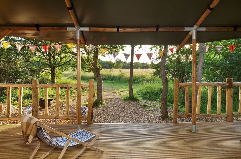
Hays Wood Retreat
Hay's Wood Retreat is a Norfolk oasis where nature and luxury harmonise, providing the perfect,… Hay's Wood Retreat is a Norfolk oasis where nature and luxury harmonise, providing the…

Theatre Royal Bury St Edmunds
Theatre Royal Bury St Edmunds is a vibrant 200-year-old theatre located in the beautiful Suffolk… Theatre Royal Bury St Edmunds is a vibrant 200-year-old theatre located in the beautiful…

Barnes Brinkcraft Day Boat Hire
Our Modern Day Launches seat up to eight people comfortably. Easy to operate, no experience… Our Modern Day Launches seat up to eight people comfortably. Easy to operate, no experience…

WWT Welney Wetland Centre
Spread your wings at WWT Welney Wetland Centre and spend a day exploring the wetlands in the heart… Spread your wings at WWT Welney Wetland Centre and spend a day exploring the wetlands in the…
Swipe to see more items
All Businesses

Lavenham Guildhall – National Trust
An impressive timber-framed building dating from 1530. Originally the hall of the Guild of Corpus…

Castle Acre Priory
Explore one of the largest and best preserved monastic sites in England dating back to 1090.

The Old Brick Kilns
A quiet, friendly, high quality park set on 3 levels. The park has tranquil, rural atmosphere. It's…

Ringshall Grange
Luxury moated Suffolk manor on 13.5 acres, hosting up to 23 guests with family-friendly,…

Norfolk Holiday Lodges
Waterside holiday lodges in the heart of the beautiful Norfolk Broads.

Paul Dickson Tours
Paul Dickson Tours runs guided walking tours in Norwich, Cromer and the Broads National Park.

Lavender Lodge
Lavender Lodge is a unique holiday property with a private indoor swimming pool and hot tub, close…

Harbour Ferry Boat Ride
Felixstowe to Harwich and Shotley Foot & Bicycle Ferry is a quick and fun to get from Felixstowe to…

Norfolk Paddle Adventure
Paddleboarding and Paddlesport provider in East Anglia. Paddle UK Coach and Coastal Leader
Stay In Touch
Sign up for our newsletter for East of England holiday ideas, places to stay, seasonal guides and local events. We’ll share inspiration for days out, coastal breaks and countryside escapes, plus occasional highlights worth bookmarking. No spam, just helpful updates when there’s something good to share.
